RIDE HIKE ROAM
HIKING · BIKING · TRAVEL, PLANNED ON PURPOSE
A blog for the more than average traveler, hiker, and mountain biker.
Bryce Canyon's hoodoos look wind-carved. The Park Service names ice and rain as the main forces, and the work happens inside the cracks.
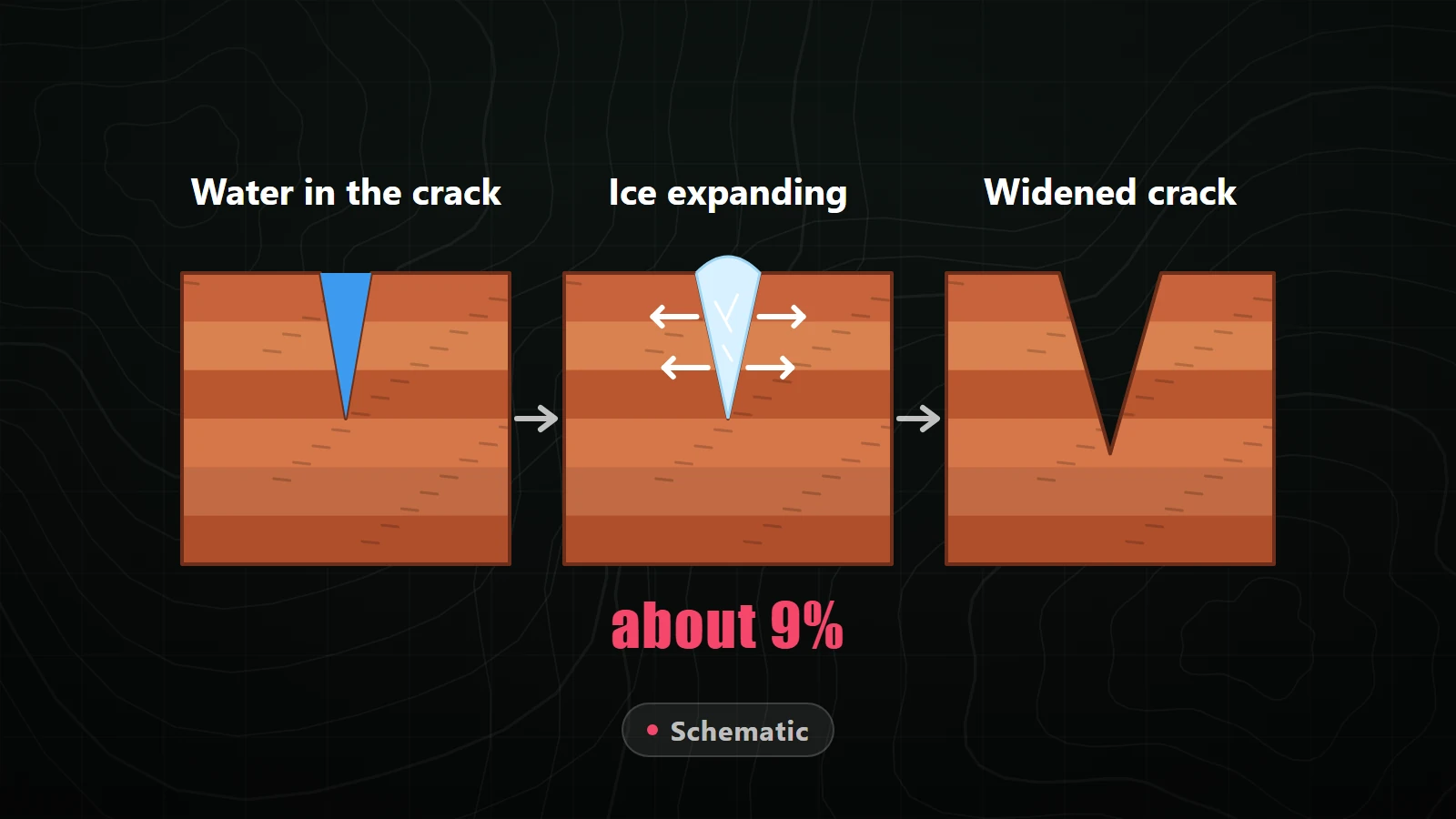
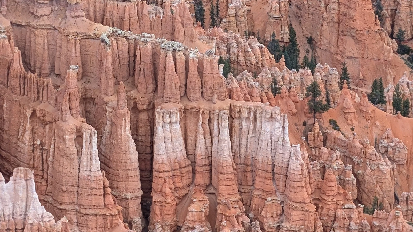
Water, in two forms. The National Park Service names ice and rain as the main forces that create Bryce Canyon’s hoodoos, and it calls frost wedging, water freezing inside cracks, the most important type of weathering in the park. Gravity and runoff haul the broken pieces away, and differences in rock strength decide what is left standing.
Stand at the rim and the hoodoos look sanded, as if something had been blasting at them for ages. Wind is the easy guess because it is the force you can feel up there.
The Park Service tells a different story. It names ice and rain as the main forces of weathering and erosion that create the hoodoos. Its page on fins goes further: frost wedging happens so often here that the park calls it the most important type of weathering at Bryce. USGS describes the same mechanism, which it calls ice wedging, breaking the rock first into walls, then windows, then hoodoos.
None of the sources I’m working from put a number on wind’s share, and I’m not going to invent one. What they agree on is who does the main work, and it shows up as water.
Rain or melted snow seeps into cracks in the rock and sits there. Hours later the temperature drops, the water freezes, and, per the Park Service, it expands by 9 percent. That expansion presses on the rock around it until the rock breaks. The park’s own description is that the ice is literally wedging the rocks apart, so the wedge picture is theirs, not mine.
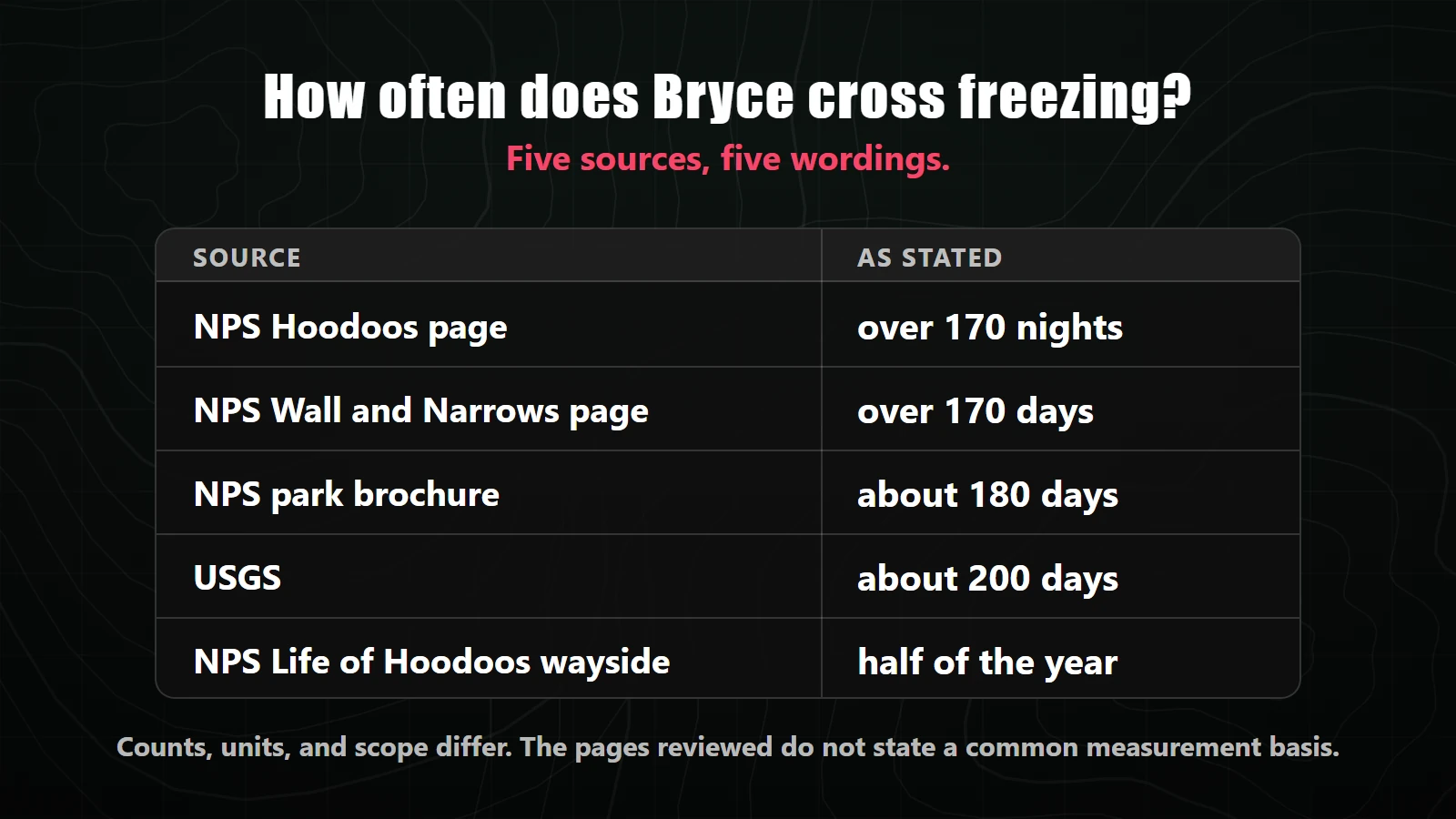
The sources agree that Bryce crosses freezing a lot. They do not agree on how often. One NPS page says over 170 nights a year, another says over 170 days, the park brochure says about 180 days, USGS says about 200 days, and the wayside at Sunrise Point says nightly temperatures fall below freezing half of the year. The first page also calls its 170 nights “more than half” the year, which it isn’t: 170 of 365 is about 47 percent (calculated: 170 ÷ 365).
The pages reviewed do not state a common measurement basis, so I’m not averaging them. Five pages, five wordings, one consistent message: it freezes a lot.
All of Bryce’s rocks contain calcium carbonate, the mineral that cements them together. USGS explains that rainwater naturally picks up a weak acid, carbonic acid, from carbon dioxide in the air, and over long periods that acid dissolves limestone. Layers with more calcium carbonate cement resist; layers with less give way. That is why a hoodoo’s sides jut out and tuck in rather than running straight.
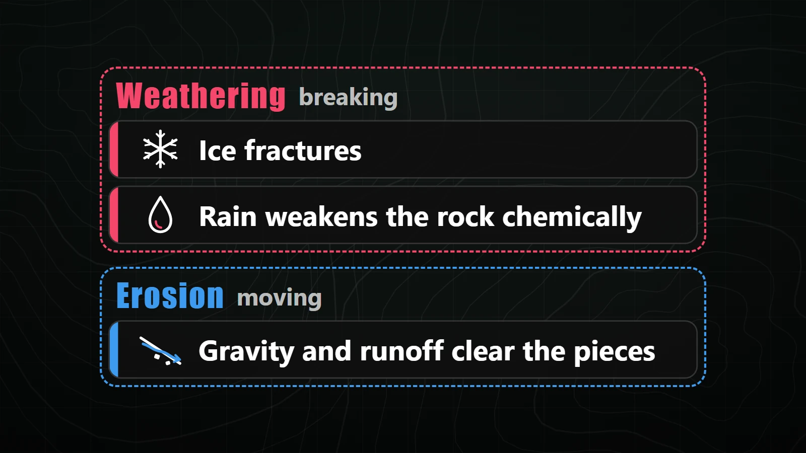
The Park Service draws the line cleanly: weathering is breaking rock down, erosion is carrying the pieces away. Ice and rain do the breaking. Getting rid of the debris is a separate job.
Here the NPS pages differ in emphasis. The fins page says summer storms send rain into the cracks, clear out the gravel that frost wedging left behind, and calls runoff the chief cause of erosion in the park. The brochure says flowing water plays only a minor role, with gravity and meltwater creeping fragments downhill and summer rain producing just enough flow to help remove the debris. I haven’t found a page that reconciles the two, so I’m not ranking them.
The brochure lays out the sequence. Rows of narrow rock walls called fins form along the cliffs. Frost wedging enlarges cracks in a fin until holes, called windows, open through it. As the windows grow, their tops collapse and leave a column. Rain then dissolves and sculpts that column into a hoodoo.
Rock strength steers the result. The Sunrise Point wayside says harder caprock layers preserve the softer rock below them. The fins page adds that some fins are capped with dolomite, a magnesium-reinforced form of limestone that the weak carbonic acid can’t dissolve.
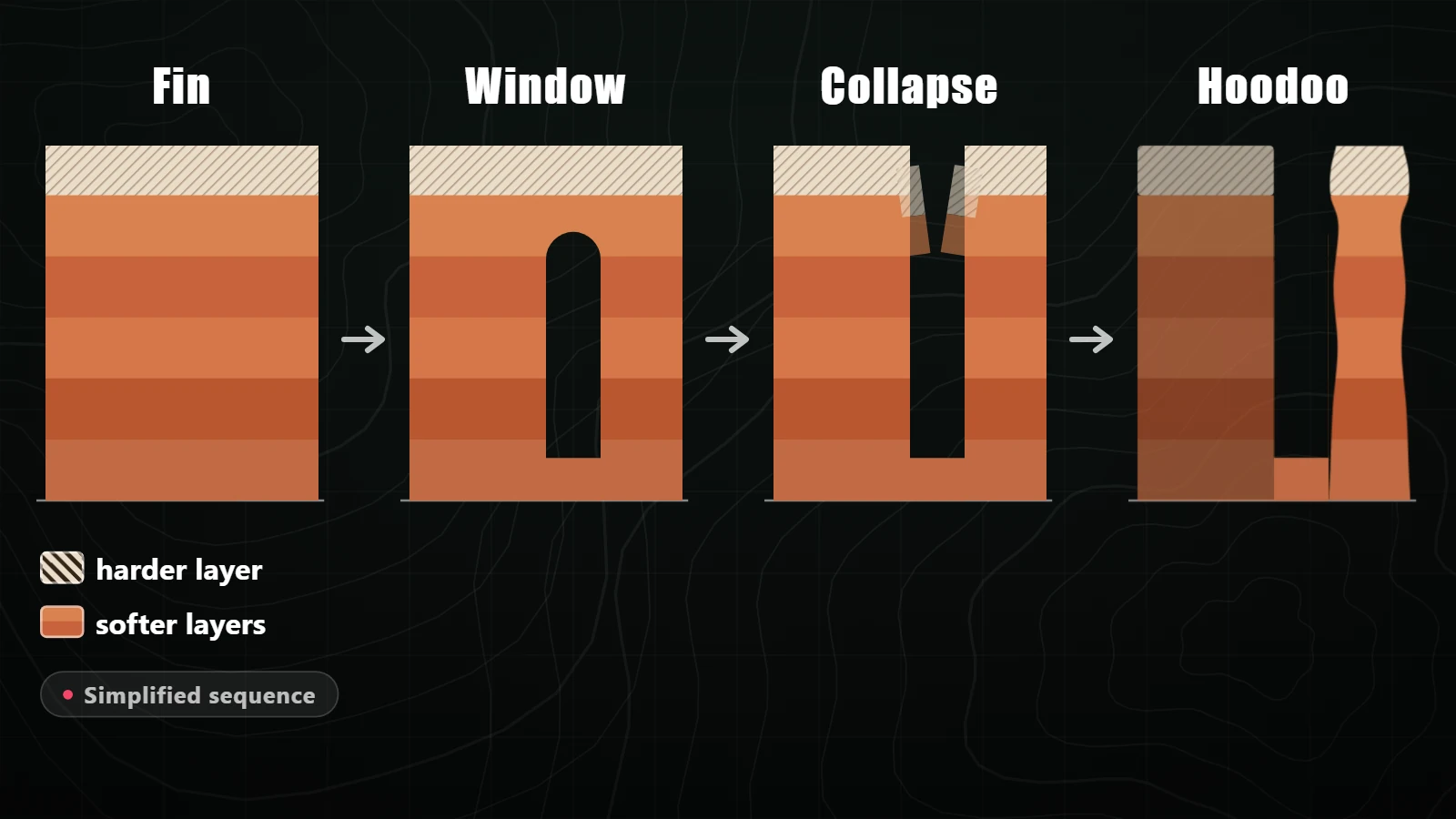
The stages are not just a diagram. The Park Service points to the China Wall on the Fairyland Loop Trail as a clean example: the outer end, exposed to weathering and erosion the longest, is mostly hoodoos, while the windows get smaller toward the rim. You are looking at the same process at different ages, lined up in a row.
The rim itself is moving too. The wayside at Sunrise Point says rain and melting snow erode the plateau edge by one to four feet every century.
The same wayside adds a forward-looking note. If rising temperatures bring fewer freeze-thaw cycles, it says, future hoodoos may be rounder, shaped more by rain and chemical weathering than by ice. The shape of a hoodoo depends on the weather that carves it, and that point is the wayside’s, not mine.
This explanation is specific to Bryce. USGS notes that slightly different formations and weathering patterns arise from the exact rock and layering in a particular place, so the balance of forces at another hoodoo landscape can differ. For how a specific formation or park works, check that park’s own geology pages or ask its rangers.
A day that crosses freezing is a temperature reading, not a counted crack. None of the figures above measure how often the rock actually breaks; that distinction is my observation, not a source’s.
Not every hoodoo has a hard cap. The fins page says some fins are capped with dolomite, not all of them, and the formation sequence above is simplified. Individual towers vary.
The wind gets the credit because it is what you feel at the rim. The work happens at night, in the cracks, while nobody is watching.
Sources last checked November 4, 2026. Agency wording and the freeze-thaw figures can change. Recheck on the publish date.