RIDE HIKE ROAM
HIKING · BIKING · TRAVEL, PLANNED ON PURPOSE
A blog for the more than average traveler, hiker, and mountain biker.
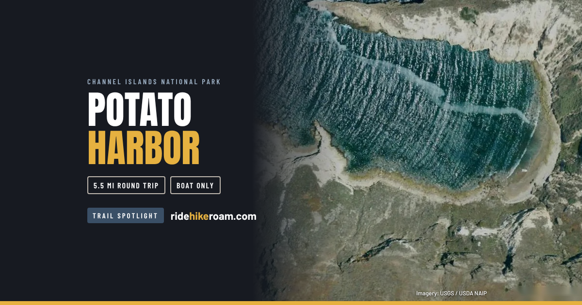
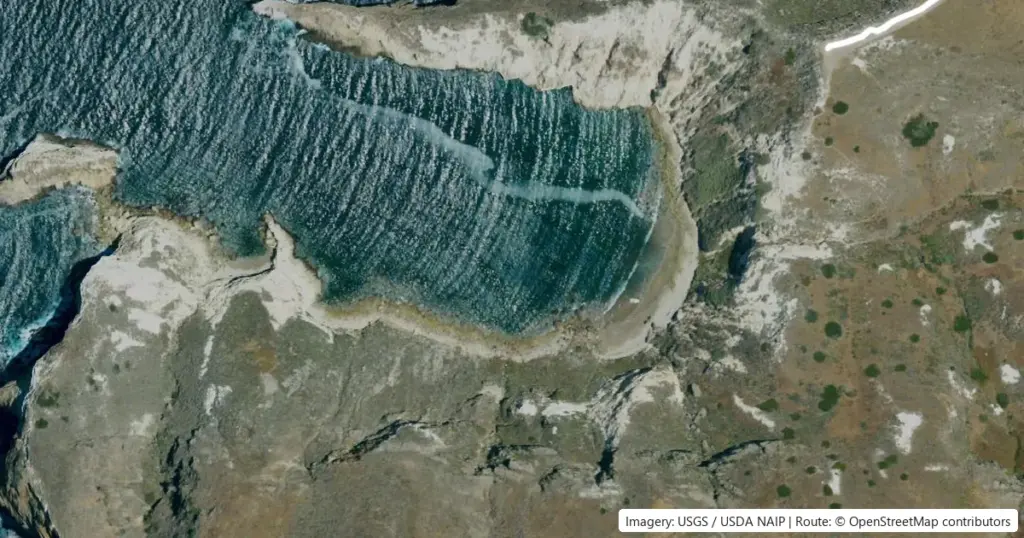
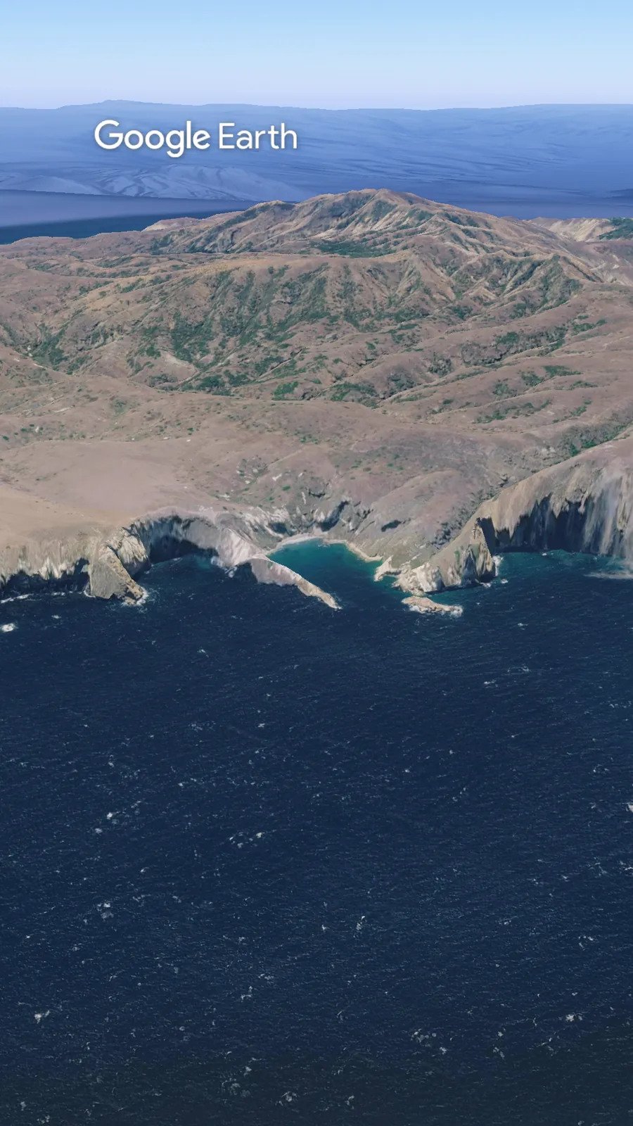
Potato Harbor is a cliff-top overlook on the north shore of Santa Cruz Island, in Channel Islands National Park. NPS lists the hike at about 5 miles round trip, rated moderate, with no access down to the water. The walking is the easy part. There is no road to this trailhead. You get there on an Island Packers boat from Ventura, and the boat schedule sets your whole day.
Potato Harbor. Santa Cruz Island. The hike is about five miles. The boat picks your turnaround.
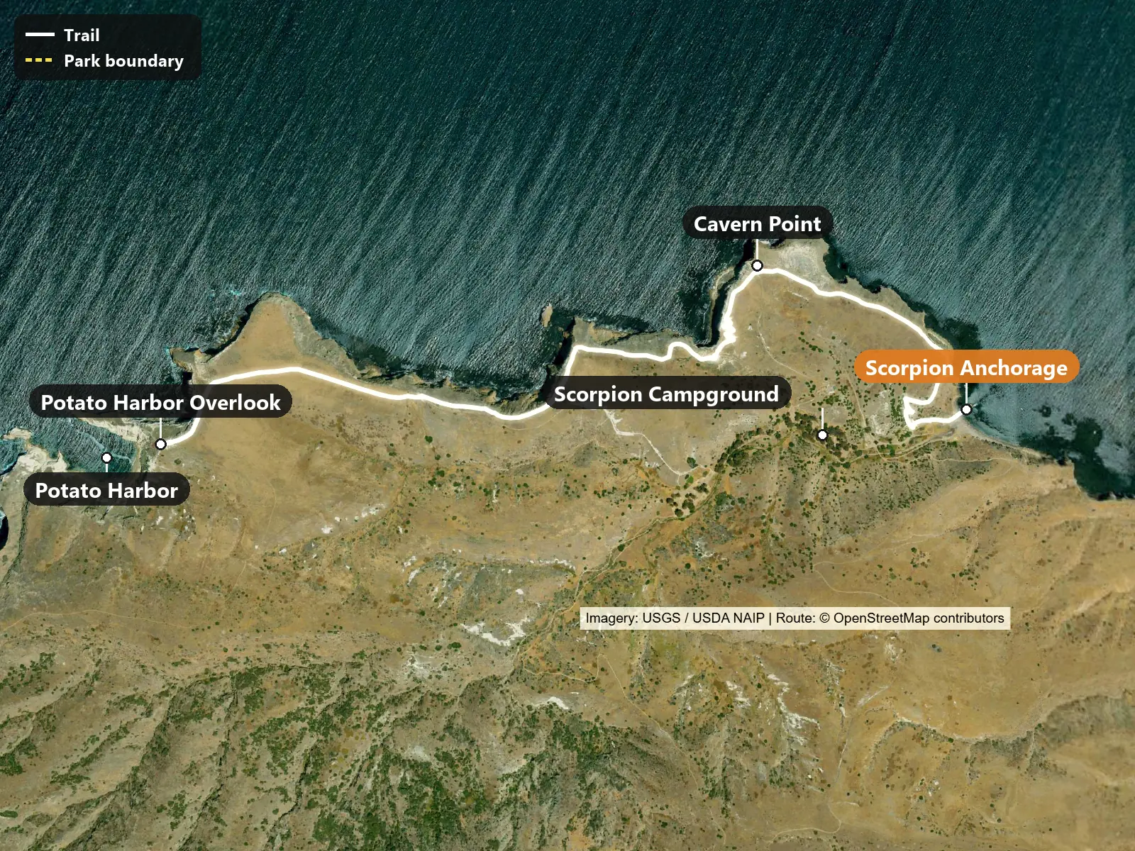
Trailhead coordinates: 34.04943, -119.55602 (directions)
Things to know before you go:
Sleep in Ventura near the harbor. Holiday Inn Express & Suites Ventura Harbor, 1080 Navigator Drive, is a short drive from the Island Packers dock. Check-in at the dock is 45 minutes before departure, so an early boat means an early alarm.
Pack the night before. There are no stores or restaurants on the island, according to Island Packers, so bring all your food and a full water bottle. Use a backpack or a closed container. NPS says to keep food away from the island foxes and birds.
Check the marine forecast. Rough seas can cancel the trip, and Island Packers makes that call at 5:30 a.m.
Vons at 2433 E Harbor Boulevard opens at 6 a.m. and is about a 10 minute drive from the Island Packers office, according to a 2025 outfitter guide. Harbor Cove Cafe next to the dock sells lunch boxes you can order online the day before, according to Island Packers. The Shell at 2099 E Harbor Boulevard is listed as open 24 hours.
On the island, water is available at the Scorpion campground, according to Island Packers and NPS. There is none at Cavern Point or the overlook. Fill up before the climb.
There is no hiking permit for this route. The boat ticket is the entry. Book the earliest landing trip you can get. On one December 2025 trip, the options were 8 or 9 a.m. out and 3 or 4 p.m. back. Schedules change by season and day, so confirm yours when you book.
Island Packers decides on weather at 5:30 a.m. and does not call passengers. Their policy also says island pickup times can change with sea conditions. Be back at the pier early.
Parking: Island Packers uses the Whale Lot at 1691 Spinnaker Drive. The harbor’s parking page lists it as free except holidays, with paid rates up to $10 a day during posted hours. Read the signs when you park.
Cell service on the island is unlikely unless you are on a hillside facing the mainland, according to NPS. Save your boat details and a map offline. No pets on the islands, and drones are not allowed in the park.
From the pier at Scorpion, the climb comes first. Then the trail runs west along the bluffs, past Cavern Point, to an overlook above the harbor. There’s no trail down to the water. Then it’s the same way back.
From the pier, walk past the visitor center to the Cavern Point trail. The climb comes first, and recent trip reports say it is the only real push of the day. NPS recommends the opposite direction, starting near the campground, if you would rather skip the steep start.
Past Cavern Point, the North Bluff Trail runs west along open bluffs, then joins Potato Harbor Road for the last stretch to the overlook. The harbor sits below steep cliffs. There is no trail down to it. Return the same way. Some trip reports loop back on Potato Harbor Road through the campground instead, which adds a different view of the interior.
NPS warns that cliff edges are crumbly and can be undercut. Stay well back. There is little shade on the bluffs. NPS also notes a possible wet creek crossing on Santa Cruz in winter and spring.
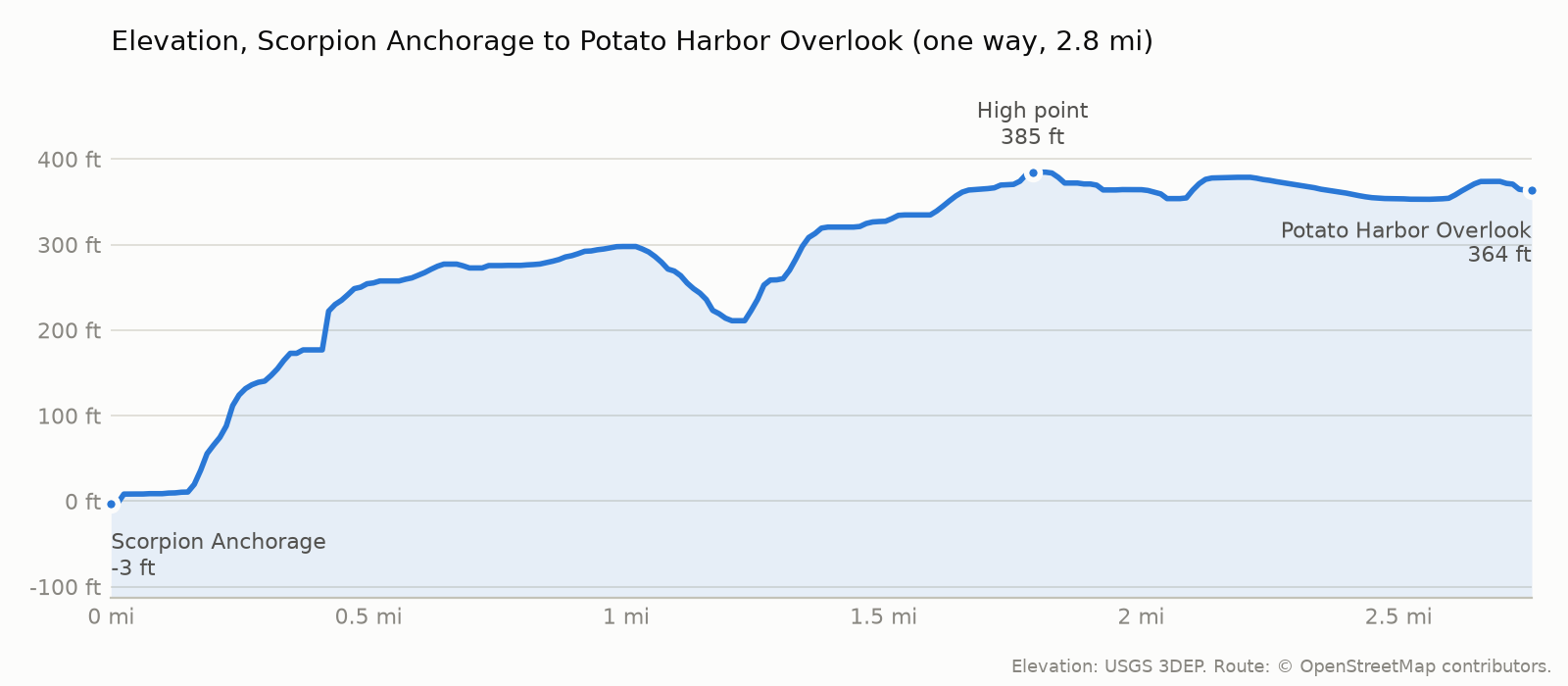
The trail starts at -3 ft, tops out at 385 ft and ends at 364 ft at Potato Harbor Overlook. The climbing is mostly on the way out: roughly 487 ft on the way out and 126 ft on the way back (USGS 3DEP elevations along the OpenStreetMap route).
Back in Ventura Harbor, Boatyard Pub at 1583 Spinnaker Drive is a short walk from the dock, according to Island Packers. Check its evening hours before you count on it. The Channel Islands National Park visitor center at 1901 Spinnaker Drive is next to the harbor village and free.
NPS lists year-round Island Packers service to Santa Cruz, with trips several days a week. Winter brings gray whales in the channel from December to mid-February, according to the seed research, but no sighting is guaranteed. Winter also brings rougher seas and more cancellations, plus mud on the trails. Spring turns the hills green. Whatever the month, plan the day backward from the return boat.
Trailhead basics
A boat-accessed island day runs on what you carry in. There are no stores out there and no water on the trail, so the short list is the whole list.
Ultima Replenisher electrolyte packets
One stick per bottle. The only water is at the campground, so what you carry is what you have.
Blue Lizard Sensitive Mineral Sunscreen SPF 50
There is little shade on the bluffs. A 3 oz tube is the size that actually gets carried.
Garmin inReach Mini 2 satellite communicator
Cell service on the island is unlikely. This sends and receives messages by satellite when the phone has no signal.
Disposable trash bags, 20 pack
Pack out everything you brought in. There are no stores on the island and the foxes will find what you leave.
Some links are affiliate links, meaning Ride Hike Roam may earn a commission at no extra cost to you.
Here’s the catch. There’s no road to this trailhead, only the Island Packers boat. In winter, return boats can leave by mid-afternoon. There are no stores out there, so bring your food. Water is at the campground, not on the trail. Rough seas can cancel the whole day. Island Packers decides at five-thirty in the morning, and they won’t call you. Check before you leave the hotel.
Island Packers makes the weather call at 5:30 a.m. and will not call you. Check the trip status from the hotel, before you drive to the harbor. If the boat goes, still be back at the pier early, because pickup times can change with the sea.
Check out more hiking posts here and don’t forget to follow Ride Hike Roam on Instagram and Facebook for real nature photography, no filters, no fluff. Hiked it? Tell us how the road was in the comments.